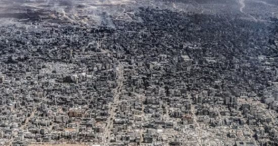
Gaza, 2023 → Gaza, 2026
Satellite images and data reveal the scale of destruction that has transformed Gaza’s cities and neighborhoods over three years of war.
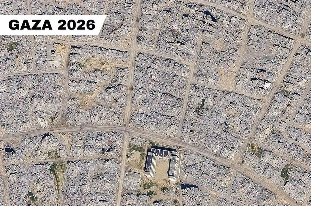
Three years can change a city beyond recognition.
Satellite images showing areas across Gaza — including Gaza City, Khan Younis and Rafah — reveal a landscape dramatically transformed between 2023 and 2026. What once stood as homes, neighborhoods, schools, streets, and places filled with everyday life now stretches into a landscape of destruction and emptiness.
The scale of what can be seen from above is reflected in the numbers.
According to the United Nations Satellite Centre (UNOSAT), as of June 16, 2026, an estimated 201,290 structures across the Gaza Strip had been damaged, representing approximately 82 percent of all structures. Of these, 134,422 structures were assessed as destroyed.
UNOSAT also estimated that 328,627 housing units had been damaged across the Gaza Strip.
The destruction has continued to reshape communities across Gaza, from Gaza City in the north to Khan Younis and Rafah in the south.
The human cost is reflected in the death toll. According to Gaza's Ministry of Health, 74,040 Palestinians had been killed and 175,168 injured as of October 1, 2026, since the beginning of the war.
But statistics cannot capture everything visible in these images.
These images show more than physical destruction. They show the loss of homes, neighborhoods and communities, and the disruption of everyday life for families across Gaza.
Behind every damaged neighborhood are people who once lived there, families whose lives have been profoundly affected, and communities that have been reshaped by the destruction.
For the people who call it home, Gaza is more than a place on a map.
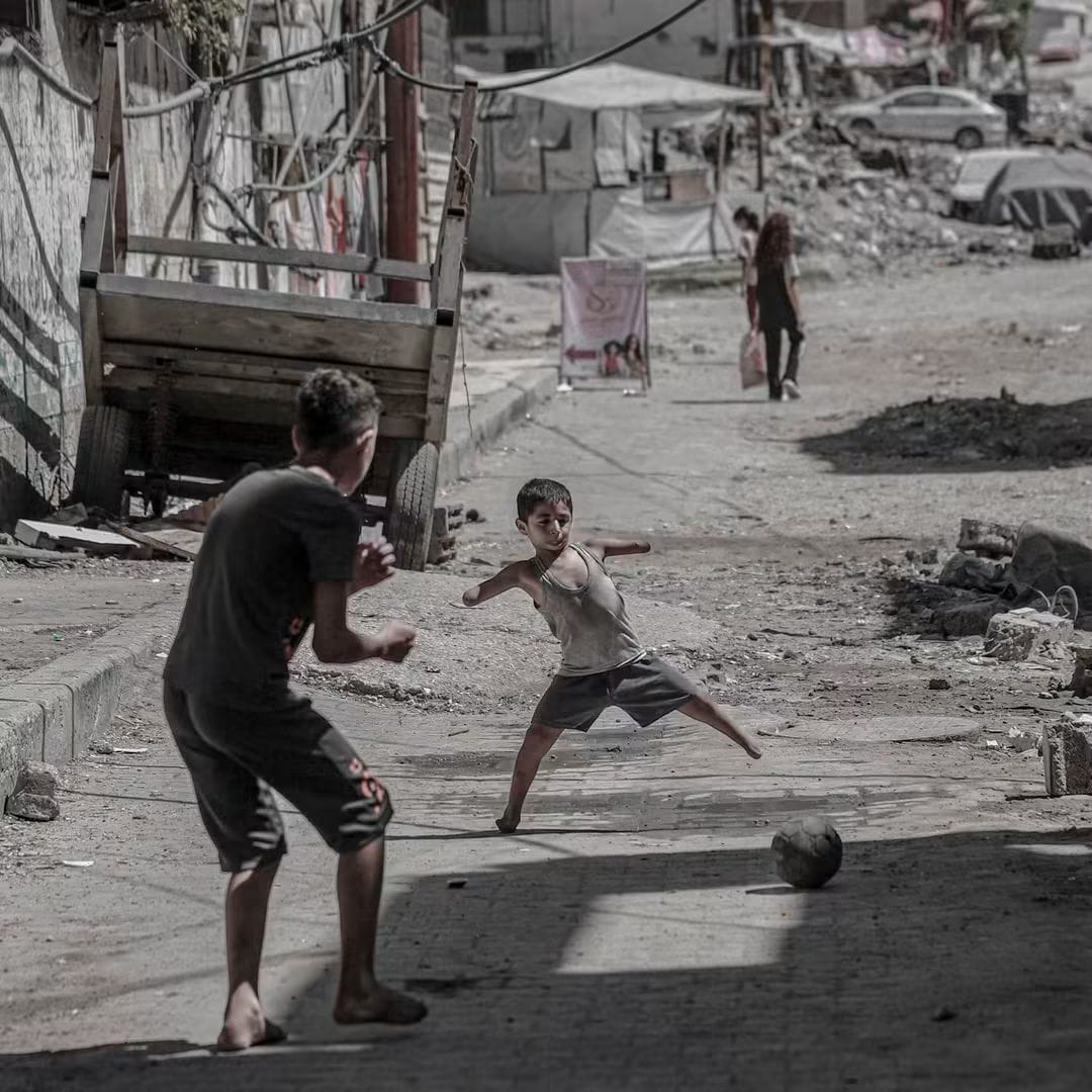
Ameer Al-Hanawi Continues to Play Football After Losing His Limbs
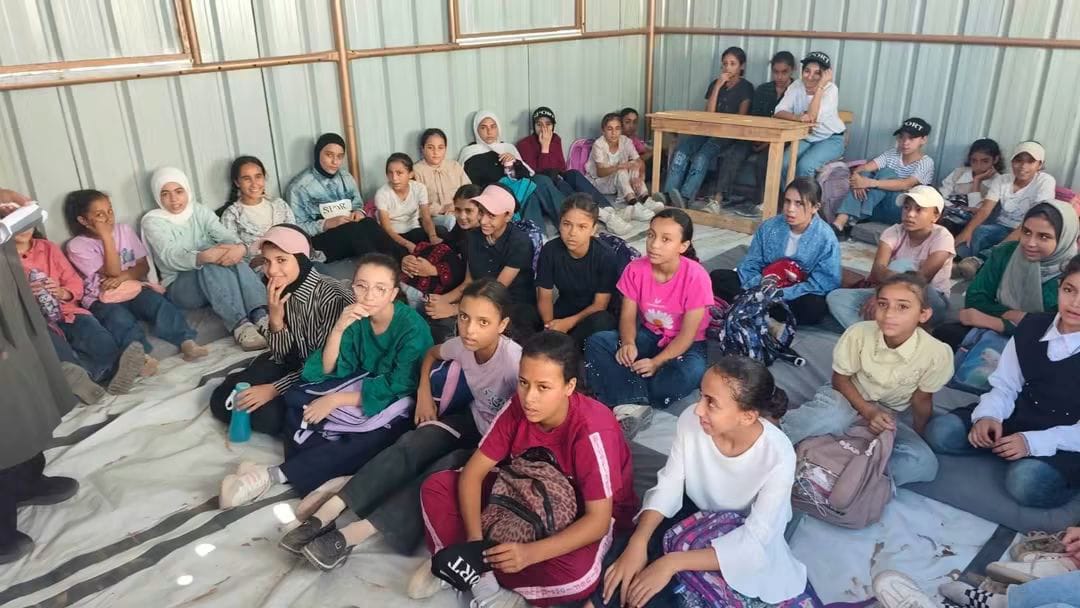
Students in Gaza Continue Their Education Despite Difficult Conditions